MSP Data
Maritime Spatial Planning Data
Geographical information is a central component and prerequisite of maritime spatial planning (MSP).
BASEMAPS
BASEMAPS is a map service to access Baltic Sea Maritime Spatial Planning (MSP) relevant data from the original source where it is stored. BASEMAPS allows users to view and download data/metadata published by national data providers through OGC open geospatial standards – WMS and WFS. It is aimed for planners, data providers and authorities dealing with maritime spatial planning in the Baltic Sea.
There are 2 sections within BASEMAPS – Input and Output data.
This terminology is used according to HELCOM-VASAB MSP Data expert sub-group to differentiate between data for plans and the plans.
MSP input data is open by default and includes various thematic data which has been considered relevant for MSP purposes. The section contains both national data harvested from national data providers (when available) as well as a centralized dataset provided by HELCOM. Users can use input data if they want to access transboundary data.
MSP output data, on the contrary, contains national MSP plans harmonized according to HELCOM‐VASAB Guidelines on transboundary MSP output data structure. Users can use output data to check what other countries in the Baltic Sea have already planned.
BASEMAPS is developed by HELCOM in cooperation with national experts from HELCOM-VASAB MSP data expert sub-group and with a support from INTERREG BSR project BalticLINes (2016-2019) and EASME funded project Pan Baltic Scope (2019-2020).
The user guide with detailed instructions on how to use BASEMAPS can be accessed through this link.
HELCOM Map & Data Service
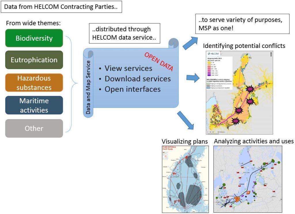
HELCOM Map & Data Service serves the needs of maritime spatial planning by
- giving the existing MSP data more visibility,
- visualizing transboundary continuity of sea uses,
- highlighting gaps in available MSP data,
- being available as a depository of Baltic MSP project GIS data.
The HELCOM Data and Map service is open access GIS server specialised in providing best available regional spatial data free of charge. HELCOM also provides direct access to all HELCOM geospatial datasets either by ArcGIS rest interface or INSPIRE compliant OGC WMS Standard and WFS can be implemented for selected datasets. HELCOM Data and Map service contains MSP-relevant datasets on human activities and marine use for easy downloading or quick overlaying purposes.
The datasets compiled in the service are originated from several HELCOM activities such as annual reporting within expert groups, periodic thematic assessments and projects.

MSP relevant data from various themes is distributed freely through HELCOM Data and Map Service.
HELCOM GIS is served by trained and experienced GIS and data management staff at HELCOM Secretariat (both permanent and project contracts), working with a full suite of professional ESRI ArcGIS licences.
The HELCOM Secretariat is involved in the project Baltic LINes as a Work Package co-leader related to data and MSP. The aim is to build the first ever Baltic Sea Region MSP data infrastructure allowing the access to decentralized datasets using OGC services.
Please contact Joni Kaitaranta (joni.kaitaranta@helcom.fi) for further details on the system.

