Baltic Marine Environment
Protection Commission


Baltic Marine Environment
Protection Commission

HELCOM to co-host a workshop on submerged munitions in the Baltic Sea at this year’s EUSBSR Annual Forum

The 14th Annual Forum of the EU Strategy for the Baltic Sea Region (EUSBSR) will take place in Riga on 4-5 October 2023. The theme of this year’s forum is Safe and Sustainable Baltic Sea Region for Future Generations, with special focus on climate affairs, green energy and future generations.

As part of the forum’s programme, HELCOM will co-host a workshop with Pomorskie Region and the Council of the Baltic Sea States (CBSS) on Submerged munitions in the Baltic Sea – environmental, security and other challenges on 4 October at 15:00-16:30 EEST. HELCOM’s Executive Secretary Rüdiger Strempel will be one of the speakers in the workshop.

Additionally, HELCOM will showcase its work related to maritime spatial planning (MSP) and hazardous substances at the expo area of the Networking Village on 5 October, which will take place at the Small Guild.

For more information about the forum and HELCOM’s presence there, please visit the event page.

HOLAS 3 thematic assessments unveil Baltic Sea ecosystem health

After several years in the making, HOLAS 3 thematic assessments on the state of the Baltic Sea have been published, covering the period of 2016–2021. The thematic assessments are part of the third HELCOM holistic assessment (HOLAS 3), providing a holistic view of the Baltic Sea ecosystem health. 

The holistic approach highlights the interconnectedness of various environmental factors and their impact on the ecosystem. The five assessment reports each focus on a specific topic, addressing the state of biodiversity, environmental pressures, eutrophication, and the relationship between humanity and nature. The findings offer valuable insights for policymakers, scientists, and stakeholders alike.

The results of HOLAS 3 have been published in stages, commencing in March 2023, and the process will culminate in the publication of the summary report State of the Baltic Sea, expected at the end of October 2023.

A comprehensive holistic assessment on the state of the Baltic Sea is conducted once every six years. The reports result from collaborative efforts among HELCOM member states, scientific experts, and organizations dedicated to the protection of the Baltic Sea. They serve as a cornerstone of HELCOM’s work and policymaking, assisting in the monitoring of the implementation and the effectiveness of the Baltic Sea Action Plan (BSAP).

Thematic assessments 2023

HELCOM Thematic assessment of economic and social analyses 2016-2021

HELCOM Thematic assessment of spatial distribution of pressures and impacts 2016-2021

HELCOM Thematic assessment of hazardous substances, marine litter, underwater noise and non-indigenous species 2016-2021

HELCOM Thematic assessment of biodiversity 2016-2021 (Main report compressed)

HELCOM Thematic assessment of eutrophication 2016-2021

New project sets sail to fulfill MSP planners’ dreams

Earlier this year, HELCOM joined a new initiative aimed at easing the lives of Maritime Spatial Planning (MSP) planners, while supporting sustainable use of human and natural capital in the Baltic Sea Region. The EU-funded Baltic Sea2Land project focuses on addressing the complexity of land-sea interactions and the overlapping jurisdictions of various public authorities, necessitating multi-level governance.

Manuel Frias, who coordinates the project at HELCOM, explains the project’s goal with a metaphor: “Public authorities, together with Sustainable Blue Economy sectors such as fishery and tourism, can be likened to a sailing boat, where the many stakeholders act as the ship’s crew. They must collaborate effectively to avoid collisions and navigate towards their intended destination. To ensure smooth sailing through these stormy land-sea interaction waters, a guiding system, a navigator, is required.”

The key output of the project is the Sea2Land Navigator, a tailored platform providing guidance and decision-making support for public authorities and Sustainable Blue Economy stakeholders, particularly MSP planners at various levels and competences.

“Land-sea interactions in Maritime Spatial Planning are difficult to grasp. We are designing a decision-making tool that will make the life of an MSP planner easier”, Frias says.

Led by the Ministry of Environmental Protection and Regional Development of Latvia, the project has 13 partners and six associated organisations from six countries in the Baltic Sea Region, including ministries, regional planning authorities, representatives of cities, and NGOs, and international actors.  HELCOM takes the lead in two activities, which focus on coordinating the design and development of the Sea2Land Navigator.

Funded by Interreg Baltic Sea Region, the project is expected to be completed by the end of 2025. HELCOM’s share of the 3.45 million € budget is 267.500€.

Find out more about the project here

HELCOM Explorer gives easy online access to follow implementing the Baltic Sea Action Plan

The recently updated online tool HELCOM Explorer allows to easily see how HELCOM cooperation bears fruit, and how the countries’ actions are being fulfilled when reaching the majority of their ambitious HELCOM targets and the ultimate goal: Baltic Sea in good ecological state.

The actions listed in the Explorer include the entire updated Baltic Sea Action Plan (2021), HELCOM Ministerial Meeting commitments from 2010 onwards as well as selected HELCOM Recommendations. The updated BSAP contains 199 concrete actions and measures addressing biodiversity, eutrophication, hazardous substances, and sea-based activities such as shipping and fisheries. In addition, it includes new actions on emerging or previously less highlighted pressures such as climate change, marine litter, pharmaceuticals, underwater noise, and seabed disturbance.

As most actions of the 2021 Baltic Sea Action Plan have a deadline years ahead, they now show red, Not accomplished, in the HELCOM Explorer.

The updated BSAP is also closely aligned with international and regional objectives such as the UN Sustainable Development Goals (SDGs), the targets of the Convention on Biological Diversity (CBD), or, for those of our Contracting Parties that are also EU members, the EU’s Marine Strategy Framework Directive (MSFD).  All actions are to be implemented by 2030 at the latest.

“As the HELCOM Explorer provides a comprehensive overview and a great amount of information on both joint and national actions, with easy filtering tools, it is quite a unique system in regional marine governance. Moreover, it is a very concrete indicator  of transparency for our stakeholders and to the broader audiences”, says Rüdiger Strempel, Executive Secretary of HELCOM.

Joint actions are carried out together by all HELCOM Contracting Parties, for example creating a new Recommendation, joint management guidelines, or assessments of environmental status. National actions are implemented at the country level, and they include e.g. incorporating the provisions of a HELCOM Recommendation into relevant national legislation or guidelines.

The Explorer allows for easy overview browsing, but also for more detailed filtering, according to the details of the actions in the Baltic Sea Action Plan such as segment, theme, or target year. The tool further provides information on why the action is needed (rationale), what pressures or activities are addressed by the action in question, and, for some, what is the potential effect of the measure to reduce pressures or improve the state of the Baltic Sea. All data is available for download.

The HELCOM Explorer tool to track the progress on the implementation of HELCOM commitments was first launched in 2016, and the interface was updated in 2020.

The reporting on the implementation of the joint actions is done by relevant HELCOM Working Groups and the reporting on the national actions by the countries. The first reporting on the implementation of actions in the 2021 BSAP is planned to take place in 2025, followed by the second reporting round in 2029.

Contact

Mock Employee
Laura Kaikkonen

Project Researcher
laura.kaikkonen@helcom.fi

Mock Employee
Susanna Kaasinen

Associate Professional Secretary
susanna.kaasinen@helcom.fi

About the Baltic Sea Action Plan (BSAP)

The Baltic Sea Action Plan (BSAP) is HELCOM’s strategic programme of measures and actions for achieving good environmental status of the sea, ultimately leading to a Baltic Sea in a healthy state.

Initially adopted by the HELCOM Contracting Parties in 2007, the 2021 BSAP is based on the original plan and maintains the same level of ambition. It also retains all actions previously agreed on that are still to be implemented, while, in addition, includes new actions to strengthen the existing efforts and tackle emerging concerns.

Guided by the HELCOM vision of “a healthy Baltic Sea environment with diverse biological components functioning in balance, resulting in a good ecological status and supporting a wide range of sustainable economic and social activities”, the updated BSAP is divided into four segments with specific goals: biodiversity, eutrophication, hazardous substances and sea-based activities.

About HELCOM Recommendations

One of the most important duties of the Helsinki Commission is to make Recommendations on measures to address certain pollution sources or areas of concern. Since the beginning of the 1980s HELCOM has adopted some 260 HELCOM Recommendations for the protection of the Baltic Sea. The implementation of various HELCOM recommendations by the HELCOM Contracting Parties plays an important role in achieving the objectives of the Baltic Sea Action Plan. The HELCOM Explorer covers the reporting on the implementation status of selected HELCOM Recommendations.

About HELCOM

The Baltic Marine Environment Protection Commission – also known as the Helsinki Commission (HELCOM) – is an intergovernmental organization (IGO) and a regional sea convention in the Baltic Sea area, consisting of ten members: the nine Baltic Sea countries Denmark, Estonia, Finland, Germany, Latvia, Lithuania, Poland, Russia and Sweden, plus the European Union. A platform for environmental policy making at the regional level, HELCOM works for a healthy Baltic Sea. Its mandate stems from a regional treaty, the Helsinki Convention, whose implementation it oversees. The HELCOM Secretariat is located in Helsinki, Finland.


Side Event at UN Ocean Conference 30 June: delivering global commitments in the Baltic Sea Region

The success of the Baltic Sea region in nominating Marine Protected Areas (MPAs) and the emerging plans regarding Other Effective Conservation Measures (OECMs) will be in key focus in a side event on 30 June 2022, taking place during the UN Ocean Conference in Lisbon, Portugal.

The aim is to present marine protection as a concrete example of the instrumental role of the regional sea conventions in implementing Sustainable Development Goal 14 – Life under water – in particular and other global commitments in general, at the macro-regional and sea-basin levels.

The side event will present HELCOM’s Baltic Sea Action Plan (BSAP) 2021–2030 as a best practice example for an ecosystem-based approach to marine management from science to action. The BSAP provides concrete tools for reaching the regional commitments, such as the establishment of a coherent MPA network, and the “30/10 target” referring to the expansion aim of the MPA coverage to 30 % of the Baltic Sea, with one third being strictly protected. The latter has a straight link to processes under Convention on Biological Diversity as well as the EU Biodiversity Strategy.

In addition to MPAs, the event focuses on the areas that are achieving the effective in-situ conservation of biodiversity outside of protected areas, so called Other Effective Conservation Measures (OECMs), as referred to in Aichi Target 11 of the Convention on Biodiversity (CBD).

Main organizers of the event are the Ministries of the Environment of Estonia and Germany (HELCOM Chair).

UN Ocean Conference, postponed due to the covid pandemic, will be held in Lisbon, Portugal. from 27 June until 1 July, 2022.

Please find here more information about the event and stay tuned for updates.

Regional maritime spatial planning moves further ahead during the joint HELCOM-VASAB MSP Working Group meeting

HELCOM-VASAB MSP WG 22-2021 was held online from 20 to 21 April 2021.

Regional coordination on maritime spatial planning (MSP) was once more the leitmotif of the latest joint HELCOM-VASAB MSP Working Group meeting, the 22nd Meeting of the joint HELCOM-VASAB Maritime Spatial Planning Working Group (HELCOM-VASAB MSP WG 22-2021) which was held online from 20 to 21 April 2021.

As part of the efforts to establish a regional MSP framework in the Baltic Sea area, it was agreed to forward the draft of the Regional Maritime Spatial Planning Roadmap 2021-2030 (MSP Roadmap) to the HELCOM decision-makers, the HELCOM Heads of Delegation (HOD), for endorsement. The MSP Roadmap is due to be adopted later this year during the next HELCOM Ministerial Meeting 2021 to be held in Lübeck, Germany on 20 October 2021. The goal of the roadmap is to facilitate and follow up the implementation of various national maritime spatial plans in the Baltic Sea as well as to lay the groundwork for their revision within an adaptive spatial planning process. 

The Baltic Sea Action Plan (BSAP) and related MSP actions were also addressed during the meeting. The BSAP is due to be updated during the MM2021 and will contain a horizontal action segment on MSP, containing the measures from the existing plan that are yet to be implemented as well as new ones. 

Updates on the various national maritime spatial plans were also given during the meeting, with almost all Baltic Sea countries either already having MSP plans in place or currently finalizing them. Denmark published its first maritime spatial plan earlier this March, and Poland had its plan adopted by its Council of Ministers this April.

The draft outline of a regional forum of MSP experts, the Planner’s Forum, was also presented during the meeting. Developed by the Capacity4MSP project that is led by VASAB, the aim of the forum, which may be hosted under the HELCOM-VASAB MSP Working Group as an expert body, is to establish a long-lasting platform for the exchange of practical knowledge on MSP. 

Furthermore, recommendations on the role of MSP in preserving marine cultural heritage was presented by the BalticRim project. Experts from the German National Academy of Sciences Leopoldina also presented their recent discussion paper on underwater archaeology “Traces under Water”, highlighting the mutual benefits of protecting both the marine environment and underwater heritage from the common pressures arising from ammunitions, ghost nets and eutrophication. Representatives of the Baltic Sea countries agreed to investigate how MSP could support preservation of underwater cultural heritage.

The Meeting was attended by all HELCOM Contracting Parties with the exception of Lithuania. Observers from the International Council for the Exploration of the Sea (ICES), the Coastal & Marine Union (EUCC) and the World Wide Fund for Nature (WWF) also participated, as did invited guests from Spatial Foresight GmbH, the EU MSP Assistance Mechanism, the Finnish Environment Institute, the BalticRIM project, the Institute for Historical Coastal Research of Wilhelmshaven, Germany, and the University of Copenhagen, Denmark. 

HELCOM publishes maps on fish habitats

HELCOM just published several maps on essential fish habitats, publicly available online on HELCOM’s Map and Data service. The maps were produced under the recently concluded Pan Baltic Scope project on maritime spatial planning (MSP) in the Baltic Sea region and to which HELCOM was a partner.

The maps show potential spawning areas of cod, sprat and herring, which are the commercially most important fish species in the Baltic Sea region, as well as key areas for European and Baltic flounder, perch and pikeperch. 

“With the maps on essential fish habitats, we now have another tool at our disposal to identify and evaluate marine areas of greater ecological importance,” said SLU Aqua’s Lena Bergström who was responsible for this component within the Pan Baltic Scope project. 

Combined with corresponding data for other ecosystem components, the maps on essential fish habitats can be used to identify regions of high ecological value and areas which have the potential to deliver various essential ecosystem services.

The maps can be found under Biodiversity section of the HELCOM Map and Data service: 

The maps can also be downloaded as raster files from the HELCOM Metadata catalogue.

The Pan Baltic Scope project was co-founded by the European Maritime and Fisheries Fund of the European Union. In the project, HELCOM notably collaborated on a data sharing activity to support regional cooperation and transboundary coherence in MSP which lead to the development of BASEMAPS, a web-based tool showing decentralized MSP data through open standard services.

The ecosystem approach conquers global maritime spatial planning event in Riga

IMG_3832.jpg
Panel discussion at the MSP Forum 2019 in Riga. © HELCOM

Not just one or two but three events on maritime spatial planning (MSP) were combined in the “Global meets regional” Maritime Spatial Planning Forum in Riga between 19 and 21 November, showing the importance that MSP is gaining in the Baltic Sea region.

The event that attracted 300 participants from over 40 countries was a grouping of the 4th International MSP Forum, the 3rd Baltic MSP Forum, and the final conference of the Pan Baltic Scope project. It focussed heavily on the ecosystem approach as well as transboundary planning between countries and frameworks.

“For HELCOM, maritime spatial planning is one of the tools at our disposal for achieving good environmental status of the Baltic Sea,” noted Rüdiger Strempel, the Executive Secretary of HELCOM, in his recap remarks.

“By promoting the ecosystem approach, [we] add the human dimension to the ecosystem, both in terms of the benefits we derive from the sea, and regarding the pressures our activities exert on the marine environment,” he said.

According to Strempel, the forum also impressively demonstrated “the broad range of disciplines and topics of relevance to and affected by MSP.” Indeed, legal issues, environmental impacts, economic and social dimensions, green infrastructure, and ecosystem services all prominently featured on the forum’s agenda, confirming the complexities and the multidisciplinary nature of MSP.

The forum furthermore served as the final conference of the EU-funded Pan Baltic Scope project on advancing MSP in the Baltic Sea region and where HELCOM led the work on economic and social analyses, and cumulative impacts.

In the project, HELCOM also collaborated on a data sharing activity to support regional cooperation and transboundary coherence in MSP. At the forum, HELCOM presented BASEMAPS, a web-based tool showing decentralized MSP data through open standard services.

“With BASEMAPS, planners can finally access a catalogue of transnational MSP data published by official data providers,” said Joni Kaitaranta, HELCOM’s data manager. The tool seeks to facilitate the development of coherent plans across the Baltic Sea region.

BASEMAPS is the result of both the Baltic LINes and Pan Baltic Scope projects, with the first focussing on input data – the data needed to produce the plans –, and the second on output data, showing national MSP plans in a harmonized way following HELCOM-VASAB guidelines on transboundary MSP output data structure in the Baltic Sea to support cross-border coherence of plans.

The forum was organized in conjunction with UNESCO’s Intergovernmental Oceanographic Commission (IOC UNESCO), VASAB, Pan Baltic Scope and the European Commission’s Directorate-General for Maritime Affairs and Fisheries (DG MARE).

And who said three: in a MSP-dominated week, the forum took place back to back with an EU MSP expert meeting on Monday, 18 November and the Capacity4MSP project partner meeting on Friday, 22 November – bumping up the count to an actual five MSP events in Riga. 

Watch Rüdiger Strempel’s recap video

Ecosystem-based management and maritime spatial planning are furthered at HELCOM-VASAB meeting in St Petersburg

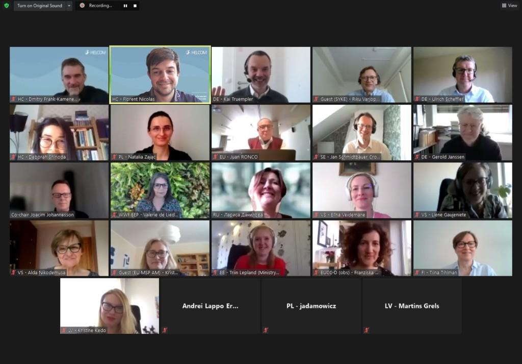
As maritime spatial planning is sharpening up in Baltic Sea region, planners and policy makers advanced on environmentally-friendly management of human sea-based activities during the last HELCOM-VASAB meeting held in St Petersburg, Russia from 28 to 29 October 2019.

“The HELCOM-VASAB Working Group is a unique platform for developing ecosystem-based management, pooling the efforts of both planners and environmentalists for better maritime spatial planning (MSP) in the Baltic Sea region,” said Dmitry Frank-Kamenetsky who oversees MSP at HELCOM.

In MSP, ecosystem-based management, or the ecosystem approach, aims at linking the conservation of marine resources with an integrated management of different human maritime activities. This approach helps to reduce the cumulative impacts on the environment caused by multiple human activities.

In St Petersburg, ecosystem-based management was a central topic as reflected by the meeting outcome, along the exchange on the state of national maritime spatial plans.

All Baltic Sea countries are currently developing maritime spatial plans or looking into the matter, with the majority already having adopted their plans and some even embarking on their revision.

As laid out in its roadmap for MSP, HELCOM-VASAB promotes the coordination between national MSP efforts to avoid incompatibilities of plans between countries within the Baltic Sea region.

MSP is also expected to feature more prominently in the update of the Baltic Sea Action Plan (BSAP), HELCOM’s strategic programme of actions to reach a good environmental status of the Baltic Sea and that is due to be updated by 2021. When the initial BSAP was adopted in 2007, there weren’t many concrete MSP activities in the region yet. At HELCOM-VASAB, it was therefore agreed that MSP finds its rightful place in the updated BSAP.

“In the Baltic Sea area, most MSP activities came to life because of the commitments made under the BSAP. Now that the region has advanced on MSP, we can see its full potential for helping us to reach our environmental goals for our sea,” said Frank-Kamenetsky.

Presented by Pan Baltic Scope during the meeting, the concept of green infrastructure (GI) showed possible ways on how to integrate MSP in the update of the BSAP. By mapping habitats and biotopes that provide essential ecosystem services, green infrastructure is an attempt to effectively link biodiversity to spatial planning.

Green infrastructure is a network of natural or semi-natural ecosystems that offer valuable services. They provide natural resources – think clean air, water and food –, regulate the environment and climate, as well as add a cultural and social value, for instance through recreational opportunities. 

Further development of the green infrastructure concept was included in the HELCOM-VASAB Work Plan for 2020-2021 to be submitted to the HELCOM countries for final approval.

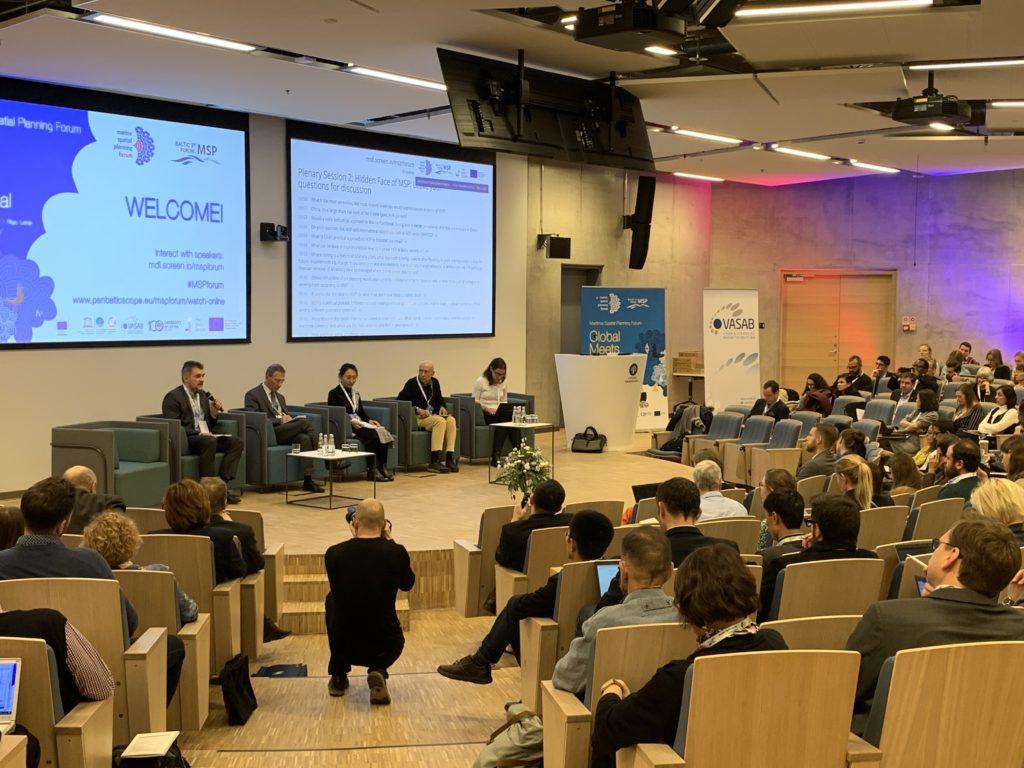
The 19th meeting of joint HELCOM-VASAB Working Group on Maritime Spatial Planning (MSP) took place during the XVIII Annual Strategic Planning Leaders Forum that, every autumn, attracts over 1000 participants from Russia and beyond.

The HELCOM-VASAB Working Group was established in 2010 to ensure cooperation among the Baltic Sea Region countries for coherent regional maritime spatial planning processes in the Baltic Sea.

Read the meeting outcome

Maritime spatial planning in the Baltic Sea region just became easier with the web-based tool BASEMAPS

basemaps_header.jpg

Why BASEMAPS?

To make their plans, maritime spatial planning (MSP) practitioners need transboundary data that is up-to-date and reliable. Working with a centralized database is often the only option to get a large amount of harmonized data. However, these centralized databases are not always up-to-date.

In 2012, to address data reliability and accuracy, the BaltSeaPlan project recommended building a tool for decentralized MSP data from the Baltic Sea region, based on marine spatial data infrastructure (MSDI). In 2016, based on this recommendation, the BalticLINes project started the development of such a decentralized but more up-to-date system. The final product, BASEMAPS, was released in 2019.

What is BASEMAPS?

BASEMAPS is a web-based tool to access Baltic MSP decentralized data through open standards services. MSP practitioners can access for the first time a catalogue of transnational MSP data published by official data providers.

BASEMAPS makes use of the open geospatial services standardized by the Open Geospatial Consortium (OGC). These tools are web map services (WMS) to view map images and web feature services (WFS) to deliver data. Likewise, the tool works also with other kind of services such as ArcGIS Rest and Download services.

What can users do with BASEMAPS?

MSP authorities and practitioners can view and download datasets, view their metadata, click on geographical features to get information, and zoom in to get more details of the area. Additionally, data providers can manage their own data in an administration panel. This password-protected panel provides an user-friendly interface for registered users to add, edit and delete data services.

Besides showing data from different national sources, BASEMAPS is being developed further in the Pan Baltic Scope project to view national MSP plans in a harmonized way. This feature will be available in BASEMAPS at the end of 2019. For more information click here.

Who developed BASEMAPS?

BASEMAPS was developed during the Interreg funded project Baltic LINes. This project aimed at propose planning solutions for linear infrastructures (cables), renewable energy and shipping lanes. There were 15 partners led by BSH.

HELCOM led a work package to develop a tool to access decentralized data based on a MSDI that later got the name BASEMAPS. The work was supported by Aalborg University.

Visit BASEMAPS at https://basemaps.helcom.fi/