The new HELCOM Map and data service (MADS) website is now live. Thanks to the Baltic Data Flows project, the HELCOM MADS has undergone a significant refresh of its user interface and visualization functionalities. Improvements include a modern and responsive user interface along with new widgets such as query layer and export map.
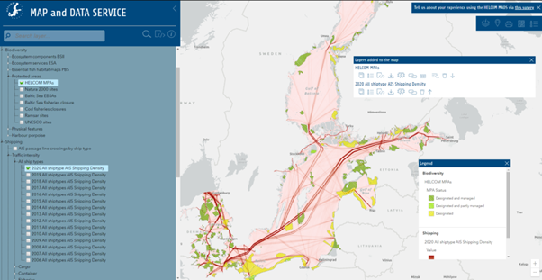
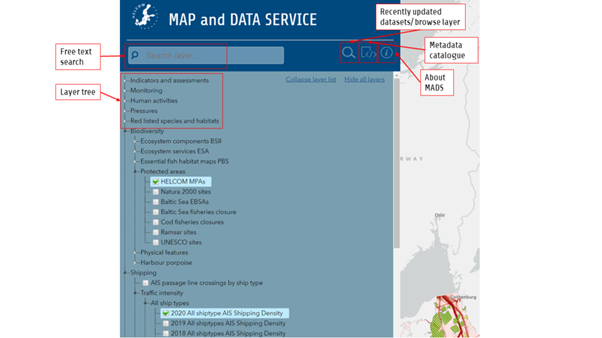
As with the previous MADS website, datasets are grouped under eight different ‘services’ that can be accessed using the free text search tool or by browsing the services layer tree (shown in the screenshot below). Multiple data layers can be added to the map explorer for conducting unique queries and analyses.
The data is also available in vector and raster formats and accessible as a service (ArcGIS Rest, OGC WMS, WFS). Each dataset is linked to the INSPIRE-compliant HELCOM Metadata catalogue record, where the data can be downloaded.
Following the selection of one or multiple datasets, the data is displayed on the map. The ‘map layers info’ box allows the further exploration of data through the selection of widgets, as shown in the screenshot below. In addition, up to 12 background maps can be selected to obtain the most relevant visualization for the user’s needs. Maps generated by users can then be printed or exported in various file formats.
Ideas for improvements were collected via user survey at the start of the project in April 2021. We are now collecting feedback on the new HELCOM MADS website to inform the project KPIs. Please take the survey here and tell us what you think (it will take less than 5 minutes).
Written by Matthew Richard, who is the Project Coordinator for the Baltic Data Flows project. This post was originally published on the Baltic Data Flows project website.